
Scotland’s Geosites – geosites.scottishgeologytrust.org
Scotland has over 1000 sites that are designated as important for geology and geomorphology at a national or local level, but the value and importance of these sites is often not recognised, it is hard to find information about them and systematic monitoring is under-resourced.
The Scottish Geology Trust’s Geosites project aims to bring information about all these sites together in one place, to make it easy for people to report issues with sites, and to share information. Our volunteers have contributed data to the Geosites map for over 400 sites so far, adding site details, including links to sources of further information, and useful notes on access and safety. Over 2,000 photographs have been uploaded, for over 400 sites.
In a separate but linked development, the Geoguide website (geoguide.scottishgeologytrust.org) gives free access to thousands of pages of text and images from publications on Scotland’s geology, including the Geological Conservation Review and excursion guides. Over 42,000 mapped locations are displayed on an interactive map allowing users to go from a map point to the description of that location.
If you would like to get involved in the Geosites project, please contact Angus Miller (angus@scottishgeologytrust.org).
Access and Geoconservation
Everyone has a right to access most land in Scotland. The Land Reform (Scotland) Act 2003 means that you can walk almost anywhere without the need to ask permission or keep to paths. Alongside this right comes the responsibility to care for your own safety, to respect people’s privacy and peace of mind and to cause no damage. This means, for instance, that you do not walk through someone’s garden or across a field of growing crops. You can find out more at www.outdooraccess-scotland.scot. The right of access does not extend to quarries, building sites and any land where public access is prohibited, or to the collection of geological samples.
Scotland’s Geosites have a range of international, national and local designations that help to safeguard Scotland’s geodiversity. This means that they are important and should be treated with respect. Geoconservation aims to maintain valuable site features, and ensure these remain visible.
You can avoid causing damage to a Geosite by:
- not reducing the extent of the geosite’s features (e.g. don’t remove rock)
- not reducing their visibility (e.g. don’t dump rubbish or paint graffiti etc), and
- not disrupting the operation of natural processes in active geosites.
You can contribute positively to geoconservation by reporting issues such as overgrown vegetation, and working with land managers to to help solve problems.
Types of Geosite
Scotland’s Geosites are variously designated as Sites of Scientific Interest (SSSI), Geological Conservation Review (GCR) sites or Local Nature Conservation Sites (Local Geodiversity Sites – LGS). Together, they represent Scotland’s world-class geodiversity, containing the evidence of geological processes of the past and present, important fossils and minerals and demonstrate the fundamental links between geology, processes, landscape, people and nature.
- Sites of Special Scientific Interest (SSSI) are areas of land with special interest for their flora or fauna, geology or geomorphology, with statutory notification by NatureScot. Find out more: www.nature.scot/professional-advice/protected-areas-and-species/protected-areas/national-designations/sites-special-scientific-interest-sssis.
- The Geological Conservation Review (GCR) is the register of known nationally and internationally important Earth science (geological and geomorphological) sites in Great Britain. These sites were identified in comprehensive expert surveys, started in 1977. There are about 880 GCR sites in Scotland, most protected as geological SSSI. Find out more: www.nature.scot/professional-advice/protected-areas-and-species/protected-areas/local-designations/geological-conservation-review-sites
- Local Geodiversity Sites (LGS) are sites of local interest, designated by local authorities and included in Local Development Plans. Find out more: www.scottishgeologytrust.org/geology/geoconservation/.
How to use the Geosites & Geoguide website
Together the Geosites and Geoguide websites represent an incredible resource for information about Scotland’s geology, unmatched by any other country in the world! The two websites are separate but linked, and to get the most out of them it is worth spending a short time understanding them.
if you spot any problems, please let us know by emailing geosites@scottishgeologytrust.org This is an entirely voluntary endeavour! Get involved, and please support the Scottish Geology Trust by becoming a member or giving a donation.
Geosites – geosites.scottishgeologytrust.org
The Geosites map only includes information about the sites in Scotland that are designated as Sites of Scientific Interest (SSSI), Geological Conservation Review (GCR) sites or Local Nature Conservation Sites (Local Geodiversity Sites – LGS). Together, these represent the best of Scotland’s geology. Our volunteers are adding photographs and information, to encourage people to visit these sites, understand their value, and help look after them.
However, the inclusion of a site on the Geosites map doesn’t mean it is easy to visit, or that it is the best place to see a particular feature. Particularly for the Geological Conservation Review sites, they have been chosen solely on their scientific merit, and that doesn’t mean that the science is easy to see or understand at that particular site. So – read the information provided before you visit. And the Geoguide website may help you find other sites nearby that are easier to visit or showcase the geology better.
How to use the Geosites website
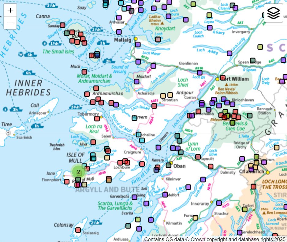
- The map menu at top right allows you to access different types of site, including the seven broad categories of the GCR sites. You can toggle these layers on and off to make it easier to find sites you are interested in.
- When you zoom in, individual site boundaries are displayed on the map.
- Clicking on a site takes you to a separate page for each site, where you can read further information, view photographs and follow links to further information (including relevant pages on the Geoguide website).
- Sites often overlap: there may be different aspects of geology that means a site is in more than one GCR block, or there may be overlap between GCR sites and Local Geodiversity Sites. Look out for links to ‘Related geosites’, and it is also worth toggling layers on and off to make sure you are not missing anything.
- The Geosites website is a work in progress: please get involved!
Geoguide – geoguide.scottishgeologytrust.org
The GeoGuide website presents published articles about geosites and allows them to be explored using an interactive map. Grid references in the text are plotted on the map, making it easy to find each locality. This should assist in discovering sites of geological interest, understanding the geology and preparing site visits. Content currently covers England, Wales and Scotland.
The Geoguide website includes thousands of pages and images drawn from a wide range of sources that have been published in the last few decades. There is a huge amount of information here, but remember it may not be up to date.
How to use the Geoguide website
- Use the map to explore localities by selecting topics of interest in the map menu (top right). Circles with numbers in them show how many points are in that area: zoom in to see the detail. Once you have zoomed in to a detailed enough map, you can click on an individual point (coloured circle) to go to the page where the grid reference is mentioned in the relevant text.
- Alternatively, from the Geoguide home page, you can browse the publications available on the site, read the text and view associated images. The accompanying map plots the locations of the grid references mentioned in the text.
- It is worth using both approaches above to make sure you are not missing useful information: in many parts of Scotland, the geology is described in multiple publications with different emphasis. You might find a technical description in the Geological Conservation Review, a more recent summary and accessible field locations in an excursion guide, and a simpler overview in another publication.
- If you get lost, the “Geoguide home” button is useful to take you back to the start, or use your browser’s back button.
Geosites pilot project 2023-2024
The Scottish Geology Trust’s Geosites project launched in June 2023, with a new map interface that shows the location and boundaries for each of the 880 Geological Conservation Review (GCR) sites in Scotland, and links to a page of information for each site. During 2024, over 500 Local Geodiversity Sites (LGS) were added to the map. In the pilot phase of the project, a team of 34 volunteers have contributed data for over 400 sites, adding site details, including links to sources of further information, and useful notes on access and safety. Over 2,000 photographs have been uploaded, for over 400 sites. We are grateful for funding and support for the pilot phase of this project from the following organisations:
The Curry Fund of the Geologist’s Association
Geological Society of Glasgow
Edinburgh Geological Society
The Quaternary Research Association
The Geosites project is on-going, if you would like to get involved, please contact Angus Miller (angus@scottishgeologytrust.org).
Data Sources
This website uses and presents data from a variety of sources:
- Information relating to GCR sites is derived from the GCR site database developed by the Joint Nature Conservation Committee.
- Site outline geometries of GCR sites in Scotland are provided by the NatureScot SiteLink database.
- The basic site information provided by the JNCC database is enhanced by volunteers, who can update and edit the metadata, and add photographs. By contributing to this site, you declare that you have permission to use the content you submit and agree to licence that content under the Creative Commons Attribution-ShareAlike 4.0 International (CC BY-SA 4.0) licence.
- Base topographic mapping is provided by the Ordnance Survey © Crown copyright and database rights 2023.
Geological overlay data are provided by the British Geological Survey. Contains British Geological Survey materials © UKRI 2023.