
Blog: North West Highlands Geopark Geotour
SGT Volunteer Maureen Whalen shares her experience participating in a recent Geotour of the North West Highlands Geopark.
North West Highlands Geopark Geotour 16th – 19th September 2024
Early Autumn 2024 – What a glorious week to visit the North West Highlands UNESCO Geopark and take part in the Geotour led by the Geopark’s Geologist Pete Harrison. The weather was superb after a bit of a cloudy start and I spent four days ‘geologising’ along with four other ‘geotourists’. We ranged in familiarity with geology and Scotland’s geology from a retired British Geological Survey palaeobotanist to an interested generalist. I fell somewhere in the middle of the continuum, being a geologist, but not having ‘grown up’ with Scotland geology.
We started, as one usually does, with tracing the history of the Geopark and the exploration and mapping of this spectacular area of Northwest Scotland, north of Ullapool.
The Geopark encompasses over 2,000 km2 extending from Ullapool north to Cape Wrath and Durness and east to include Loch Eriboll, Kylesku (home of the Geopark’s Rock Stop Café and visitor’s centre), and the Bone Caves near Inchnadamph. That’s a lot of ground to cover in just four days! We had to be selective and there’s always more to see on the next trip. You can learn more about the Geopark in their recent leaflet (https://nwhgeopark.com/wp-content/uploads/FINAL-LEAFLET-2023_v4.pdf). The primary purpose of the North West Highlands Geopark as part of the UNESCO Geopark programme is to promote geoconservation, sustainable (geo)tourism, the local community and economy, and geoscience informal education in an outdoor setting. The North West Highlands Geopark does this and more! Recent news from the Geopark include a ‘MyGeopark Story’ competition and plans for an Astro Night in Coigach – 23rd January 2025 (https://nwhgeopark.com/events/list/).
I found the development of the understanding of the geology of the Northwest Highlands to be as fascinating as the geology itself. The ‘highlands controversy’ about the processes that formed the rocks and the geologists who explored them persisted through the 1800s was finally resolved in a large part due to fieldwork undertaken by Victorian geologists, Peach and Horne in the late 1800’s, (for a great summary see: https://nwhgeopark.com/landscape/the-highlands-controversy-early-progress-1/). This excellent example of the scientific method laid the ‘groundwork’ for years of exploration, education, discussion, further discussion with each newly found understanding leading to further questions. The best of science!
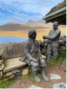
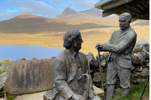
Knockan Crag Visitor’s Centre, Statues of Peach and Horne. Photograph courtesy of Maureen Whalen
After becoming oriented to the layout of the Geopark and visiting the Knockan Crag visitor’s centre to learn about Peach and Horne who famously mapped the area in the late 1800’s, we followed the geology northwards geographically and back in time. We were encouraged to make our own observations, developing our understanding of the geology, rather than simply being told. Pete was there to answer questions and guide the discussion.
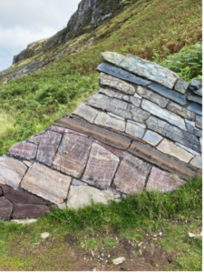
A rock wall depicting the geological layers of the North West Highlands. Photograph courtesy of Maureen Whalen
Looking at the roadcuts and outcrops of the ‘recent’ Moine Thrust zone (430 million years ago) over the older rocks, we discussed how their depositional environments changed as the smashed together pieces of the Earth’s crust that make up this part of Scotland moved from the just south of the equator to their current location. It’s a complex and fascinating story that deserves more attention than a few sentences in a blog; I encourage you to do some research of your own.
We also explored evidence of how people have used these rocks to build not only rock walls, but brochs such as the 2,000 year old Clachtoll Broch just south of Stoer Beach, Assynt (https://www.clachtollbroch.com/).
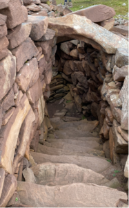
Stairway between the stone walls of Clachtoll Broch, Assynt. Photograph courtesy of Maureen Whalen.
I ended as I began, fascinated with why our landscape appears the way it does, how it got there, and a deep admiration for the generations of geologists, academics, community members, creatives, and local governments who work to query, preserve, enhance, and showcase the best understanding of the world around us.
Many thanks to Pete Harrison, the North West Highlands Geopark, and my fellow ‘geologisers’.
Maureen